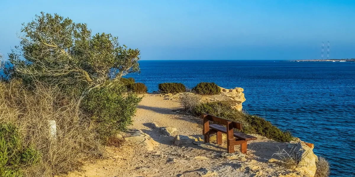
The South West Coast Path runs for around 630 miles from Minehead in Somerset to Poole Harbour in Dorset, which makes it England's longest National Trail. That number can be intimidating. It shouldn't be. Almost nobody walks it in one go, and you certainly don't have to. A six-mile stretch around a headland, ending in a village with a bus stop and a decent pot of tea, is a proper day out.
Coastal walking is different from a walk in the woods, though. The ground is often steeper and looser, the weather hits harder, and in some places the sea decides whether your route exists at all. Here's how to plan a first day that you'll enjoy rather than endure.
Start by picking the section, not the day. Get an Ordnance Survey Explorer map of the area you fancy and look for a stretch of coast with two things: a settlement at each end and a road or bus route between them. Avoid the wilder stretches — the far west of Cornwall and parts of north Devon — until you know how your legs cope with repeated climbs.
Escape routes matter more than scenery. If the weather turns or someone in your group flags, you want a lane, a village or a bus stop within a couple of miles, not a ten-mile commitment along an exposed cliff.
Tide is the single thing beginner coastal walkers underestimate. Around Britain there are usually two high and two low waters a day, and high water arrives roughly fifty minutes later each day, so yesterday's times are no guide to today's.
Tides matter for three reasons on the coast path. Some stretches drop onto beaches that disappear at high water. A few estuary and river crossings depend on low tide or on a ferry that only runs at certain states of the tide. And any cove you walk into can become a trap if the water comes back behind you.
Practical habits:
Large parts of the South West Coast Path have no fence between you and the drop. That's part of its charm, and it's why the path deserves respect.
Walk a good metre or two back from the edge, and further on wet or loose ground. Cliffs along this coast are made of materials that crumble, slump and undercut, and a lip that looks solid can be nothing but an overhang held together by grass. After heavy rain, treat every edge as suspect. If a section has been officially diverted inland, follow the diversion — it's there because something has moved or is about to.
Watch your footing on steep, stepped descents into coves, especially where the surface is loose shale, wet clay or worn stone. Walking poles help more than most beginners expect, particularly on the ups.
Headlands are their own microclimate. Wind is stronger, rain arrives sideways, and in summer there's very little shade on open cliff tops. Sea fog can roll in within minutes and take your view of the next landmark with it.
Check a forecast on the morning of the walk and be willing to change your plan. If strong winds, thunderstorms or persistent fog are forecast, pick a sheltered inland or wooded section instead, or drop to a lower-level route. Turning back is a sensible decision, not a failure. Coastal rescue teams are called out regularly for walkers who pushed on, and if you do need help, dial 999 and ask for the coastguard — though mobile signal is patchy on many stretches, so tell someone at home your route and expected finish time.
On the coast path, two miles an hour is a realistic planning figure for a beginner, including stops and the climbs that come with every headland. Fit walkers might manage more; families with young children often manage less.
A five to eight mile day is a good first target. Pick something with a village or a bus stop roughly halfway, and don't be seduced by a low total distance on the map — a six-mile coastal stretch can contain several hundred metres of ascent in short, steep bursts that feel nothing like six miles on the flat.
The good news is that the South West Coast Path is unusually well served by public transport for a long-distance trail. Mainline trains reach Exeter, Plymouth, Truro, Penzance, Barnstaple, Weymouth and Dorchester, with branch lines and local services running to places like St Ives and Newquay. Buses fill the gaps, and short ferries — Padstow to Rock, for example — link some headlands and estuaries.
The catch is that many rural coastal buses are seasonal, run only a few times a day, or stop early in the evening. So:
Pick a five or six mile stretch between two villages with a bus link. Check the tide and the forecast. Set off in the morning, walk towards your transport-linked finish, and aim to be done by mid-afternoon, leaving daylight in hand. Tell someone where you're going and when you expect to be back.
Then stop at the pub, take your boots off and look at the map for next time. The coast path rewards repetition: the same headland in different weather is a different walk.
If you have a heart condition, joint problems, diabetes or any other health concern, or you're pregnant, speak to a GP or another qualified health professional before taking on steep, uneven coastal ground. It's a short conversation that makes the day far easier to enjoy.

How to walk through British villages and farmland without causing offence: gates, livestock, driveways, rights of...

A practical guide to minimising your impact on the British countryside, covering path use, waste, wildlife...

Learn to read contour lines with confidence — spot steep ground, judge gradients and plan a climb or descent that...

Exploring paths, places, and stories of rural Britain..
